

Nautical Charts
Thematic Cartography / Geological
Surface Sediments of the Portuguese Continental Shelf Chart
The “Surface Sediments of the Portuguese Continental Shelf Chart”, belonging to the “Sedimentological Series”, is made up of eight sub-charts at 1:150 000 scale. The eight sub-charts cover the Portuguese Continental Shelf according to the following sub-divisions:
- SED 1-From Caminha to Espinho;
- SED 2-From Espinho to Cape Mondego;
- SED 3-From Cape Mondego to Cape Carvoeiro;
- SED 4-From Cape Carvoeiro to Cape Roca;
- SED 5- From Cape Roca to Cape Sines;
- SED 6- From Cape Sines to Cape S. Vicente;
- SED 7/8- From Cape S. Vicente to Guadiana River.
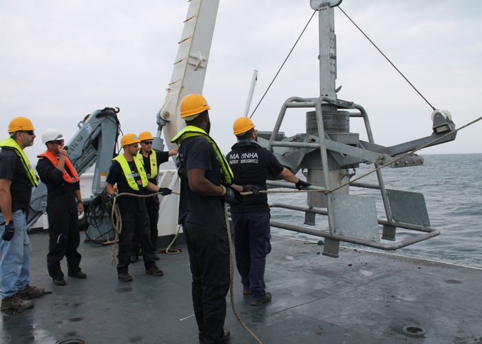
These charts were elaborated based on Program SEPLAT, whose objective was to chart the sea-bottom superficial sediment cover. This program was conducted at the Hydrographic Institute from 1974 up to 2010 and was fully financed by the Portuguese Navy, with the main objective of substituting the old “Submarine Lithological Charts” published between 1913 and 1941.
The oceanographic surveys carried out under Program SEPLAT allowed the collection of thousands of superficial sediment samples of the seafloor along the whole of the Continental Portuguese Coast (from Minho to Algarve), from the coastline up to 500 m depth, with a rectangular sampling net of 1 nautical mile (1 852 meters). This same area was also covered by additional surveys using geophysical methods (seismic reflection) which allowed the characterization of, not only the superficial sediment cover, but also of the underlying geological structure and the identification and charting of the rock outcrops.
The sediment samples collected during the SEPLAT surveys, after being processed in the Sedimentology Lab (link), provide the necessary information to draw and construct the Sedimentological Charts. The adopted sample classification is based on the combined analysis of grain size and carbonate content.
The construction of the sedimentological charts is a dynamic process and in constant actualization. As the possibility of collecting new geological information from the areas covered by the SED charts arises, in the context of oceanographic surveys dedicated to this specific purpose, or to others that can be adapted to the same, this information is then used to update the present deposit cartography.
SEDMAR Charts (under construction)
The SEDMAR (SEDimentary cover of the Madeira ARchipelago) Project is currently under way at the hydrographic Institute. Its main objective is to map the marine ecosystems of the national territory, as far as the sea bottom characterization of the Madeira Islands’ shelf and slope, in order to extend the “Surface Sediments of the Portuguese Continental Shelf Chart” to the Madeira Archipelago. This extension will result in the publication of 3 new sub-charts covering the Madeira and Desertas islands, Porto Santo Island and the Selvagens Islands, respectively.
To this end, the hydrographic Institute is currently executing and planning a series of oceanographic surveys covering the area of the Madeira Archipelago which include:
- Bathymetric coverage of the whole area using a multibeam echo sounder (from the coast line and 3000 m depth) which will also allow for the indirect bottom type classification, allowing for the distinction between rock outcrop and different sedimentary deposits;
- Geophysical survey using seismic reflection (sub-bottom profiler) which will provide information about the sediment layers’ architecture and thickness as well as the confirmation and delimitation of the rock outcrops;
- Sediment collection allowing the representative sampling of the different sedimentary deposits identified by the geophysical survey’s results. Similarly to what has been the routine procedure during the SEPLAT program, these samples will be processed in the Sedimentology Lab in order to provide a similar classification according to their texture (grain size and mineral composition), geochemistry as well as biological characterization (in the scope of scientific collaboration with several institutions).
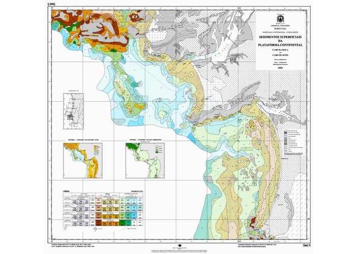
carta seplat cabo roca cabo sines
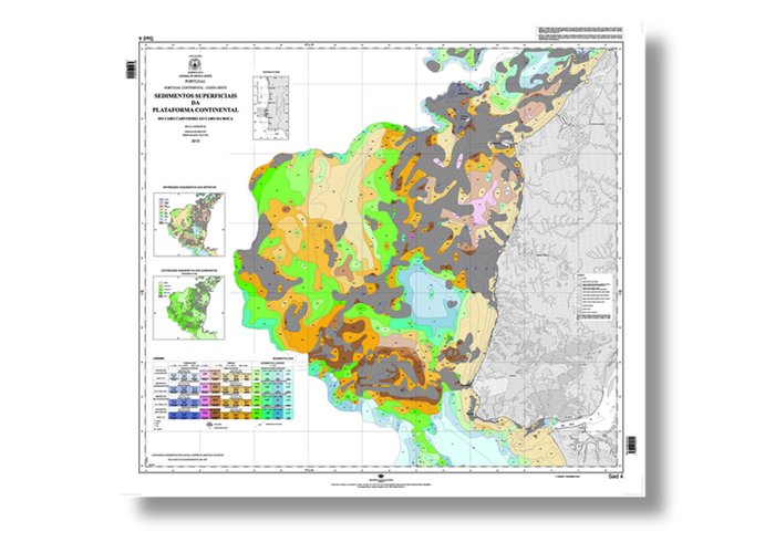
SEPLAT. Folha SED 4 - Do Cabo Carvoeiro ao Cabo da Roca.
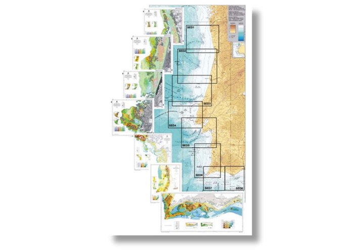
Folhas SEPLAT
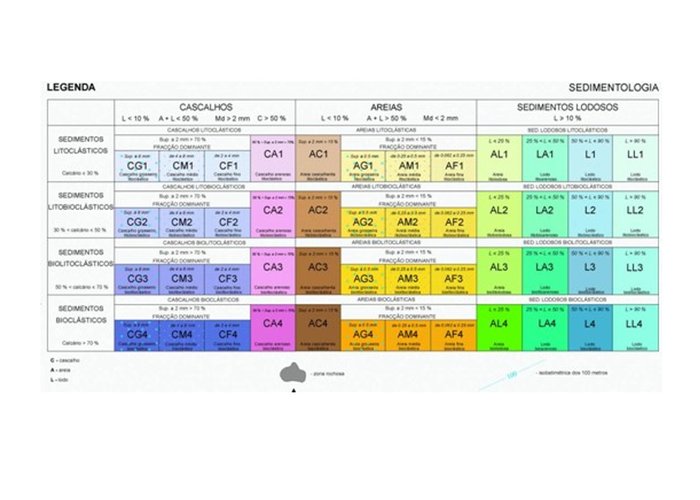
Legenda SEPLAT
SEDMAR
1
2018-02-20